 The Saratoga Gap trails sits high up in the mountains around Saratoga, CA. It's not too far from the highway, but to get to the trail head you drive through the quaint town and begin the long, windy drive up into the mountains. After 6 miles of slow, serpentine, California road you crest the peak and the trailhead is there on your right.
I woke up to my cell phone alarm this morning at 6:30; my regular bedside alarm is set for 9:30. Why change a good thing? I tried to snooze but Sparky was already up. He knows an early morning alarm means a bike ride and he was ready to go. He bounded up to my bed with his exuberant full-body wag and started licking my face as insurance that I wouldn't be falling back asleep.
Outside it was dark and cold. I threw on a hoodie, grabbed a Naked Juice and Odwalla Bar, and hit the road. I meant to leave at 7:00 and was running a bit late but luckily the early-morning the traffic was a sleepy as I was.
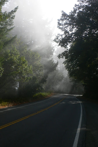 In an earlier post I talked about how Bay Area trails are "one big up and one big down" -- well Saratoga Gap is an exception to that. It also has some of the best views in the area and as I looked up at the hazy skies on my drive in, I worried that the scenery would be sub par today.
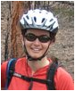
I made it to the trailhead just a few minutes late to find John there and ready to go, sessioning obstacles in the lot. A few minutes later my buddy Chris arrived. The last time he rode this trail, his rear wheel ate his derailleur on the first climb, snapping spokes like toothpicks and taking him off his bike for a couple weeks while it was fixed up. Would Lady Luck be on his side today? Erinne and I finish suiting up, I turn on my brand new GPS device, which finds almost a dozen satellites in a few seconds, and we're ready to go.
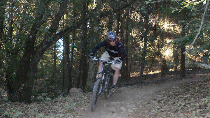 I'm riding my single speed, so Sparky and I take the lead. There's a short steep climb at the beginning of the trail that dumps you into sweet, flowy singletrack that runs through switchbacks, over rocks and roots, and into nice banked turns. It's one of my favorite sections of the ride. I let the bike take off under my weight and float through the first couple miles hammering the short climbs and flying through the descents.
There's an official speed limit on the trail of 15 mph and when I stop at an intersection to regroup, my GPS says I've reached a top speed of 26mph. It's tight, twisty singletrack that's popular with hikers too, so I keep a vigilant eye and ring my bell at blind corners. Most days I use the bell to antagonize friends on climbs, but it occasionally has a practical use as well. As it turns out, this morning we'll have the trail all to ourselves.
John and Erinne catch up with some bad news; Chris got a flat in the first mile and, without a spare tube, he decided to hike out. For him, Saratoga Gap will have to wait.
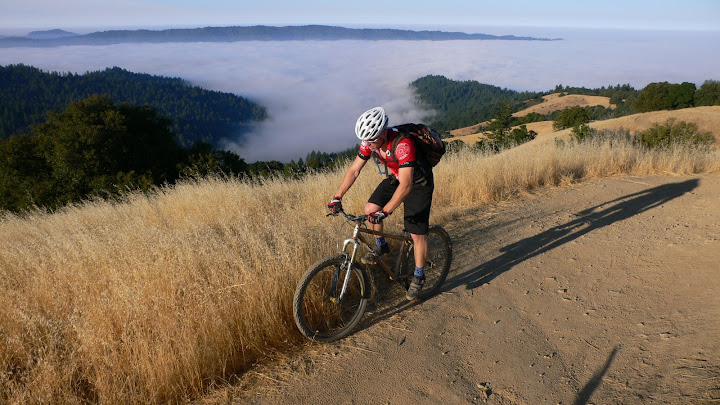
We ride on and, as we crest the highpoint of the ride, all my fears about the view are assuaged. Below us usually stretches rolling, grassy hills which meld into forested mountains and finally drop into the Pacific Ocean. Today there was no ocean but the sea of clouds blanketing the valley floor and coastline.
After the vista point, we pick up a little fireroad and link up some more single track. We dive back into the forest, and descend a couple hundred feet to our lowest point in the ride. Up on the fireroad it was sunny, dusty, and warm. Down here the thick smell of the forest floor fills your nostrils and the cold wet air envelops your body like a glove, a nice refreshing breath of literal cold air before the long switchback climb back out.
We hit the fireroad again and begin to retrace our ride, back to the vista point, and then descend the other side. What's my favorite section on the way in is always a challenge on the way out, a long drawn-out climb sprinkled with roots and rocks to finish. There's a couple making out at the trailhead, "on your right."
 Back in the parking lot Sparky prostrates himself on the cool pavement and we look over the initial GPS data. The moving time is pretty good, although the 10 mile ride can usually be done in about an hour or less solo. Plus we spent about half an hour stopped for photos, but data looks nice and matching the pics (most taken at the bench waypoint) with Earth's rendering (KML) gives a fresh perspective on the trail.


1 comment:
真人啪啪福利直播平台 , 色女视频裸聊 , 刺激的一对一视频聊天 , 免费一对一视频聊天 , 美女直播网,免费视频luoliao,激情裸聊天室 , 裸liao女的qq,视频聊天室,美女luoliao,裸聊免费聊天室官方 , yy色群,恋夜秀场1站大厅,裸聊视频聊天,激情luoliao , 激情YY聊天室 , 女孩一对一视频聊天 , 真人在线裸聊网 , 裸聊直播间在线qq激情,mm视频聊 , 免费视频美女网站 , 成人聊天裸体聊天 , 美女免费直播网站-超碰免费视频 , 网红主播视频av网站 , 免费午夜激情聊天室官方 , 台湾辣妹视讯聊天室 , 台湾辣妹视讯聊天室 , 台湾辣妹视讯聊天室 , 美女视频直播秀 , 超碰免费在线成人视频 , 美女主播真人秀 , av在线观看网址-恋夜秀场诱惑直播 , 免费一对一多视讯 , mm色色裸聊,聊吧交友,美女激情视频聊天 , 真人视讯聊天交友 , 免费交友网站 , 成人性爱表演 , 成人聊天室 , 超碰免费人人网视频 , 免费色直播聊天室 , 真人秀视频聊天室 , 免费聊天室 , 午夜聊天交友网
Post a Comment